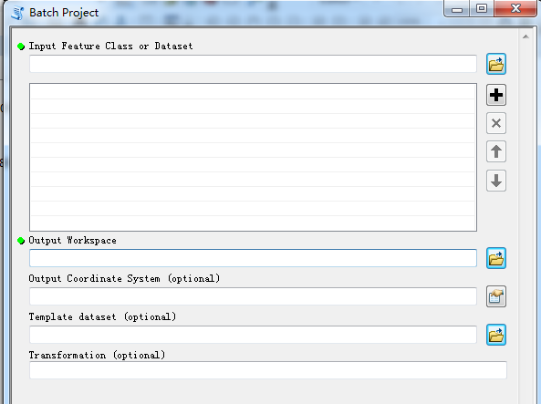
ArcTools有工具Data Management Tools/Projections and Transformations/Feature/Batch Project,见上图。
在运行这个窗口之前,先定义椭球转换参数,即运行Create Custom Geographic Transformation;
然后,运行上面的窗口,
输入要转换的图层----Input Feature Class
定义输出空间--Output Workspace,就是定义一个gdb文件
定义输出坐标系统---Output Coordinate System,选择输出的坐标系统
定义转换参数--Transformation(Optional)这个是可选的,自动匹配已经定义好的椭球转换参数。

