
英文原文
Obtaining multi-source satellite geodesy and ocean observationdata to map the high-resolution global digital elevation models(DEMs) is a formidable task at present. The key theoretical andtechnological obstacles to fine modeling must be overcome beforethe geographical distribution of ocean opography and plate movement patterns can be explored. Geodesy, oceanography, global climate change, seafloor plate tectonics, and national ocean interests will all benefit greatly from this data assistance. Finer than 100-m resolution global DEMs were not available until the 2020s, whenthe world’s 30-m resolution land NASADEM and FABDEM were made freely available [1]. Acquiring bathymetric data is far more challenging than collecting terrestrial surface data since sonarbased procedures are needed. Because of the large quantity of data,it takes more time and requires more computational resources to make global DEM maps with higher resolution [2]. These data fusions have various accuracy difficulties because of the different resolutions and sensors. A deep learning technique known as super-resolution (SR) has been used to identify and compensate for the differences between resolutions and sensors [3,4]. The 30-m resolution NASADEM, GEBCO_2021 data, and numerous highresolution (HR) regional ocean DEM datasets are all publicly available,making it feasible to generate a global DEM dataset with a 3 arc-second resolution.
A large number of training samples are needed to generate a robust deep learning network model. Although there is a large quantity of terrestrial data, if the model is trained using a terrestrial sample set, the resulting model is only applicable to the terrestrial domain. There is evidence that the topography of the land and oceans is very similar. Plate movements cause the oceans and land to evolve constantly [5]. Transfer learning can use learned knowledge from a source domain to solve a new but related problem in a target domain [6]. As a result, this study leverages the similarities between land and ocean to compensate for a relative lack of bathymetric data. NASADEM is a data collection with a resolution of 1 arc-second (30 m) that covers 80% of the Earth’s territory between 60N and 56S latitude without bathymetry data. It improved phase unfolding to reduce data voids, facilitating greater completeness as well as providing additional SRTM radar-related data products [7]. The GEBCO_2021 Grid provides global coverage on a 15 arc-second grid with 43,200 rows and 86,400 columns for a total of 3,732,480,000 data points [8]. When compared to land regional DEM datasets, the resolution of ocean regions remains poor, and enormous areas of the ocean are sampled fairly coarsely[3]. The main contribution of this paper is pre-training the neural network model with GEBCO_2021 and NASADEM land samples,followed by additional fine-tuning with limited regional ocean DEM data. The HR DEM dataset corresponding to the GEBCO_2021 land area was formed by downsampling the 1 arc-second NASADEMwith the bicubic interpolation method. The TanDEM-X 3 arc-second data was obtained by TerraSAR-X’s ‘‘twin” satellite using synthetic aperture radars (SAR) interferometer technology.Certain terrestrial area investigations have shown its higher accuracy than other global DEMs [9]. However, in comparison to NASADEM,no gap filling or interpolation was applied to this data, and thus invalid data exists [10]. TanDEM-X 3 arc-second data (A1–A4 in Fig. 1a) were chosen for testing terrestrial regions to better validate the accuracy of the model. Other HR regional ocean DEM datasets, obtained by single-beam, multi-beam, chart data, andsatellite inversion technologies, were downsampled for transfer learning and testing (B–G in Fig. 1a). The acquisition period, sensor type, post-processing, and geographical extent vary between these ocean DEM datasets (listed in Table S1 online). The reference systems used in these DEM datasets varied. Some were gathered with the support of EGM96 geoid orthogonal heights. To ensure consistency,each dataset was converted to the WGS84 coordinate system before subtracting the difference between the local geoid and the EGM96 geoid from the reference DEM values. All DEM datasets were finally converted to the EGM96 geoid. The grayscale values of the DEM were normalized to values between 0 and 1 to accelerate model convergence.
To generate the training and validation sets in this study, a random 80/20 split was performed on the dataset, which contained approximately 579,900 globally distributed land sample units.The transfer learning and testing dataset for fine-tuning contained approximately 28,500 ocean samples that were evenly distributed across the oceanic regions of the world. During the preprocessing phase, ArcGIS 10.3 and Python GDAL were used to preprocess theentire dataset. HR NASADEM and regional ocean DEMs were split into 160 160 pixel patches, while LR (low-resolution) GEBCO_2021 was split into 32 32 pixel patches. Missing DEM values were removed from the dataset prior to patching.
A deep residual network called DEM-SRNet is proposed to pretrain the terrestrial DEM data. As illustrated in Fig. 2, the designed pre-training structure is derived from the enhanced deep superresolutionnetwork (EDSR) [11]. The first convolutional layer of the pre-trained DEM-SRNet network extracts a collection of features.The EDSR models default number of residual blocks was expanded to 32 [5]. Through experimental comparison, the optimalnumber of residual blocks (ResBlocks) is 42, each of which is composed of two convolutional layers that are interpolated with a ReLU activation function and finally, followed by a convolutional layer and an element-wise addition layer (+symbol in Fig. 2). This latter includes a convolution layer for extracting feature maps; an interpolating layer with a scale factor of 5 is utilized for upsampling from an input low resolution of 15 arc-second data to a target high resolution of 3 arc-second data; and finally, the convolutional layer aggregates the feature maps in the low-resolution space and generates the SR output data. With the interpolation function layer, low-resolution data can be super-resolved without checkerboard artifacts, as opposed to typical deconvolutional layers [12].When there are a large number of feature maps, the training process becomes unstable. Setting the residual scaling [11] to 0.1solves the problem.
The network is made up of 88 convolutional layers, 43 elementwise addition layers, and one interpolating layer. The convolutional kernel size in each convolutional layer is set to 3, and the padding is set to 1. There are 50,734,080 network parameters in total. The Adam optimizer with an initial learning rate of 0.0001 and the exponential decay method are used to train the model with the large dataset during the training phase. The early stopping technique with a patience of 6 is used to terminate training when the model’s performance begins to deteriorate in the validation set to prevent overfitting. The mini-batch gradient descent method typically requires 300 epochs to build a pre-training network from scratch. The initial parameters are derived from the terrestrial data pre-training network. The freeze layers of the pre-training network are employed in conjunction with the limited HR ocean DEMs to fine-tune the global DEM-SR model. As fine-tuning samples are limited, the learning rate has a significant impact on the convergence process. The learning rate is then adjusted down to 0.00001.
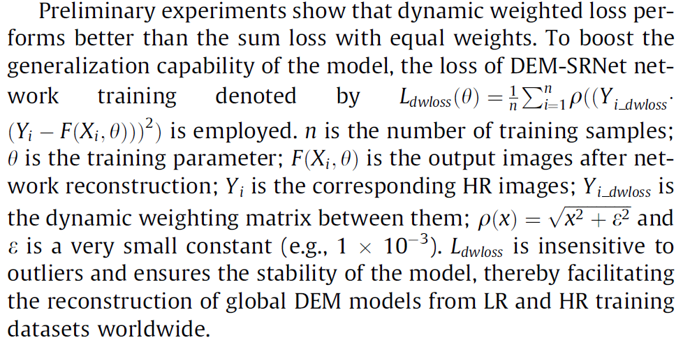
Preliminary experiments show that dynamic weighted loss performs better than the sum loss with equal weights. To boost the generalization capability of the model, the loss of DEM-SRNet network training denoted by LdwlossðhÞ ¼ 1n Pni¼1qððYi dwlossðYi FðXi; hÞÞÞ2Þ is employed. n is the number of training samples;h is the training parameter; FðXi; hÞ is the output images after network reconstruction; Yi is the corresponding HR images; Yi dwloss is the dynamic weighting matrix between them; qðxÞ ¼ ffixffiffi2ffiffiffiþffiffiffiffiffieffiffi2ffiffip and e is a very small constant (e.g., 1 103). Ldwloss is insensitive to outliers and ensures the stability of the model, thereby facilitating the reconstruction of global DEM models from LR and HR training datasets worldwide.
The global DEM super-resolution, which ultimately reconstructs 90 m (3 arc-second) resolution global raster images,requires the computational generation of approximately 93.3 billion pixels for the elevation value. There are 64 GB of training sample data as model inputs. This study employs Huawei’s Ascend 910 AI (artificial intelligent), which includes two Ascend 910 CPUs with 48 cores and 512 GB of RAM (random access memory). For model development, MindSpore employs the open-source Python programming language environment [13], the hybrid training mode of host and accelerator for distributed training, and the MindRecord format for data processing and format conversion. ModelArts,an open cloud platform based on MindSpore that aims to improve overall AI development efficiency by providing ample computing and storage resources, is used for all experiments.
As a result, ‘‘GDEM_2022”, a 3 arc-second global DEM dataset,was developed. The GDEM_2022 ocean data was inherited from the 15 arc-second resolution ocean bathymetry map GEBCO_2021.GEBCO_2021 incorporates bathymetric data from various ocean topographies, such as the IHO Digital Bathymetric Data Center for Digital Bathymetry (IHO-DCDB) and crowdsourced bathymetric data [8], which indirectly become DEM-SRNet training samples. To further boost the DEM-SRNet model’s credibility, we incorporated as many high-resolution ocean datasets as feasible to supplement the data samples, as shown in Fig. 1a, B–G. Please note that we downsampled NASADEM data with the bicubic interpolation method for replacement in terrestrial areas. The gathered HR regional ocean DEM datasets were integrated and updated for the GDEM_2022 ocean areas. Modern multibeam echosounders can obtain higher resolution ocean topography data than satellite altimeter-based technology. Mapping 100-meter resolution ocean topography datasets takes around billions of dollars and 200 ship-years [14]. This technology not only expedites the precise mapping of the seafloor and the generation of global HR bathymetric maps, but also produces such maps at a lower cost than the equipment-based method. DEM-SRNet still achieves good superresolution effectiveness in glacierized locations such as the Arctic Circle, as shown by the worldwide topographic distribution depicted in Fig. 1a. An average improvement in RMSE of 23.75% may be seen in Table 1 from our DEM-SRNet over the bicubic (traditional) interpolation. Land testing regions show that the DEMSRNet model outperforms the existing SR models in terms of RMSE.
Residual-based approaches such as ESRGAN and EDSR perform better in ocean area testing than convolutional networks such as SRCNN and VDSR. As shown in Table 2, the average reduction in MAE was 19.58 m, over 63.99% of absolute error less than 10 m globally. When GDEM_2022 and EBCO_2021 are compared, the most notable differences are the increased spatial detail in GDEM_2022, as shown in Fig. 1b. In some instances, GDEM_2022 terrestrial areas have better visual and detail outputs than their predecessors (part of A1–A4 in Fig. 1b). GDEM_2022 outperforms in coastal areas, reducing coastline jaggies to an absolute minimum (part of D, F, and G in Fig. 1b) (Fig. S1 online). GDEM_2022 can improve bathymetric mapping in marine and Gulf areas by reducing ocean area blur (part of B, C, and E in Fig. 1b).
In summary, this study presents the development of a new 3 arc-second global DEM dataset ‘‘GDEM_2022”. It can meet the knowledge requirements of ocean topographic data in basic science and practical applications, e.g., resource exploration, tsunami hazard assessment, and territorial claims under the Law of the Sea [14]. Similar efforts in urban DEM super-resolution [6,15] and partial ocean area super-resolution [3] have been made, but never on a global scale. The experiments in Table 2 demonstrate that the mean absolute vertical error between GDEM_2022 and HR regional ocean DEM datasets reached 19.58 m, with over 63.99% of the absolute error being less than 10 m. In terms of clarity and detail, GDEM_2022 outperforms GEBCO_2021. Future efforts will concentrate on enhancing the SR model’s capacity to identify and eradicate systematic error information from low-resolution input images. Insufficient samples are still the limitations of our current work. Obtaining more HR ocean sample datasets to improve model generalizability and accuracy is a crucial future topic to address. We anticipate that the GDEM_2022 dataset and the DEM-SRNet model for obtaining HR bathymetric data from around the world will expand the DEM data community and motivate other research groups to accomplish superior outcomes.